A Hike at Heil Valley Ranch
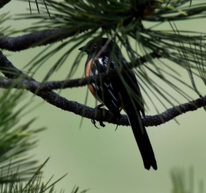
Spotted Towhee – Heil Valley Ranch. Boulder County Parks and Open Space. May 9, 2018. (R. Prince photo).
Our last two hikes this spring were at Colorado state parks – Roxborough and Staunton – but today went to a Boulder County Parks and Open Space hiking area. We tend to try trails at lower elevations this time of year – 6000 – 8000 feet altitude – both because the winter snows have not yet melted higher up and because it is more agreeable to hike the foothills of the Rockies before the summer heat sets in from mid June onward and the rattle snakes come up from the depths to sun themselves.
The state parks have a $7 entrance fee, but the Boulder County Parks and Open Space hiking areas are free. The trails of both kinds are well maintained and quite lovely. Given that the national parks are victims of huge Trumpty-Dumpty era funding cuts, that the state and county parks are well maintained especially here in Colorado (and less known) seeking out these places to hike and explore is worth the effort. Besides, I am continually startled – having lived in Colorado for a shade less than fifty years now – how much more there is to explore, and how little of the state I know…as one who has hiked its mountains and plains all year round during this half century.
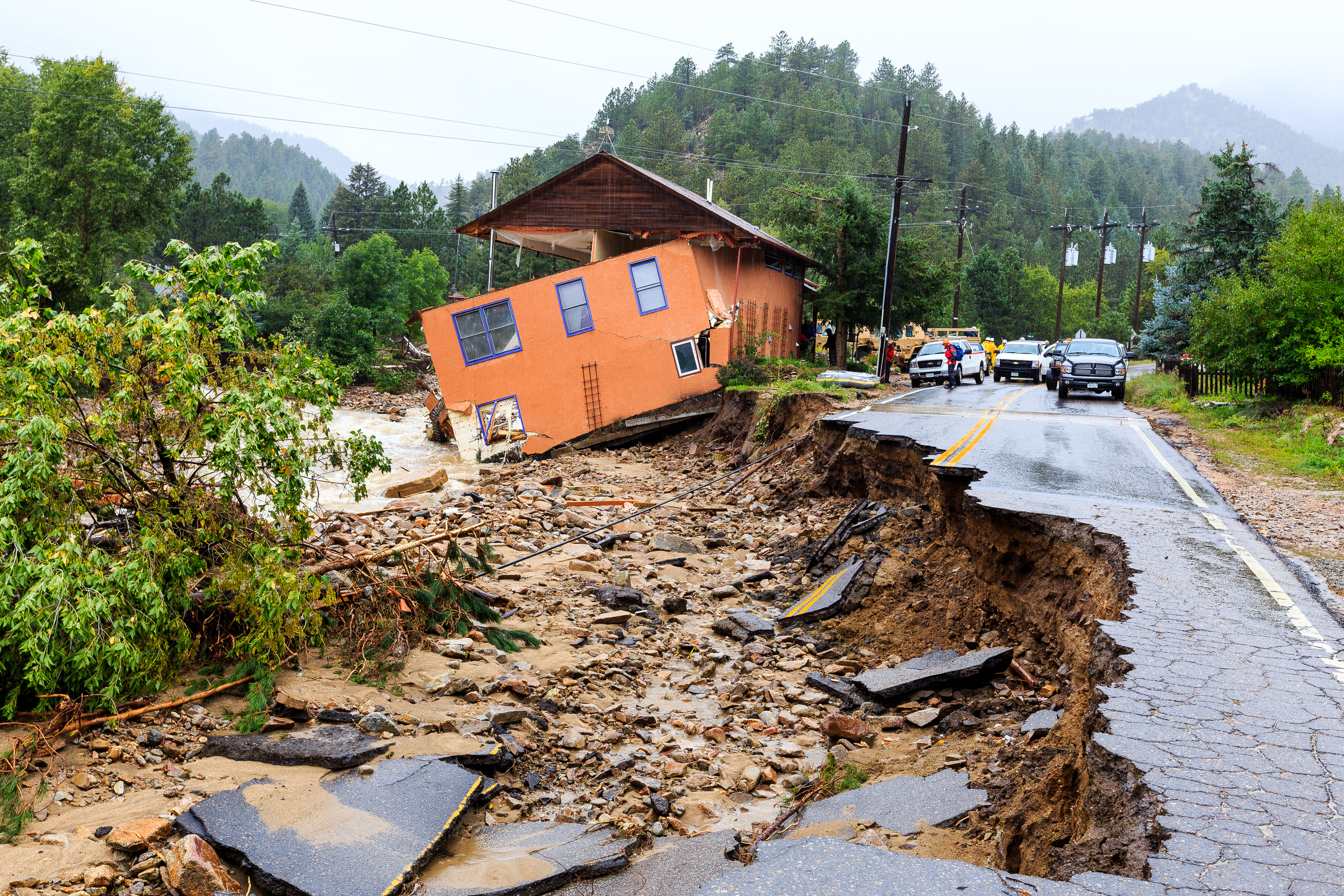
Yesterday, May 10, from Denver, we (Nancy and I) headed north of Boulder on Highway 36, turned left into the mountains onto Left Hand Canyon, the road to Jamestown, site of a nasty September, 2013 flood that swept away most of the town’s main street buildings. A little more than a mile up the Jamestown road from Highway 36, there is a sign for the Heil Valley Ranch. The Heil Valley Ranch not very high up into the hills, the altitude there on our hike measured from 5850 to 6100 ft. above sea level, hardly above that of Denver. It is a mix of pine forests and open areas with a stream running through it, a tributary of Left Hand Creek.
One could see some examples of mining activity on the Heil Valley Ranch “Lichen Loup” Trail but for the most part, after white settlement, the area has been used for its timber, and cattle grazing. According to one of the trail sign’s at the ranch…there were at least four Native American camp sights on the property. They are not marked, probably for good reason, but here and there I noticed what might have been circles of rocks that might have been ancient (or not so ancient) camp fires. Regardless, with its milder climate than further up the mountains, bountiful game drinking at the stream, and in places, lush greenery, the place would surely have made a fine home for game…and the hunters and gathers who stalked them.
Anglos first used the site for beaver trapping, then starting in around 1860, to provide lumber products for Front Range construction projects as the area started to absorb increasing Euro-American populations. In 1948 the Heil Family bought the land using it to graze Hereford cattle through the 1970s. In 1996 along with the adjoining Hall Ranch, Heil Valley Ranch was purchased by Boulder County and made into a state park.
Over the years since the Colorado gold rush of the 1850s, like so many other areas in the Colorado Rockies, Left Hand Creek has been the target of mining activities. Before World War I, the Beryl Lode Mine produced small amounts of beryl and mica. The New Girl Mine operated there from 1928 to 1945 producing feldspar and mica, but like Beryl Lode Mine the mineral reserves proved to be rather meager. Three other mines, the Elkhorn, CalWood and Highline also operated in the area for short periods.
 The above photo looks south from a point along the pass – the different peaks in the background are different geological formations. Compare this photo on the left with the trail sign on the right..it was pretty cool to see – and somewhat understand – what is more than 300 million years of geological history in one snap shot.
The valley in which the Lichen Loup is located is wedged between two of these geological formations. Just east of the path there what is referred to here in Colorado as a “hogback” essentially a ridge. The valley that makes up the better part of Heil Valley Ranch sits between that ridge on its eastern flank and the rising Southern Rockies to the west. The hogback is topped by a layer of Dakota sandstone that dates from about 100 million years ago. Turn around, face the Rockies rising to the west to see the rising darker red stones of the Lyon’s Formation, much older at some 280 million years ago. The Lyons Formation red rocks were quarried on the property of the Heil Valley Ranch (prior to its becoming a ranch) there during the same period, providing some of the Lyons Formation (280 million years ago) red rocks for which the region is famous.
Lyons Formation red rocks have been widely used for construction throughout the Colorado Front Range; these rocks make up many of the building blocks of University of Colorado – Boulder structures, but not only there. One sees many turn-of-the-20th century homes and office buildings throughout Colorado made of the stuff. There is still a major outlet for Lyons Formation red rocks in – of course – Lyons Colorado at the Loukenon Family Quarry just up the road a piece from the Stone Bridge Farm where Nancy and her siblings spent a good portion of their youth.
Depending upon one’s fitness and energy level, one can do a rather easy hike at Heil Valley Ranch or a more rigorous one. We did the Lichen Loup, a little less than 2 miles. It is a pretty easy hike, just right with anyone with arthritic knees and hips (like someone I know) but sufficiently breathtaking to feel one is in the midst of natural wonder. For the hardier types – a few of them passed our way, there is what is referred to as the “Wapiki Trail” which follows the foothills north several miles towards Lyons. It’s the kind of hike I used to easily do “back in the day” but would a bit more difficult these days.
 One must always remember hiking in the Rockies, that there is big game in them thar hills. Mountain lions and black bear included. For the most part, as brother-in-law David Fey puts it “you don’t see them; they see you.” Sightings are rare, but they do happen. In 49 years of hiking Colorado mountain trails I have seen a mountain lion once (1978 up Cement Creek by Crested Butte – no one I was with that day believed me), black bear four or five times (most recently last spring on a hike with Molly and friend Sabina Durmishi in the mountains west of Boulder) and twice rattle snakes. On the other hand I have frequently seen “skat” (animal poop) – as it is referred to here – and foot prints and have learned to identify their source over the years.
At Heil Valley Ranch we didn’t see any bears, mountain lions – just a few birds (the spotted towhee pictured at the outset of the blog entry). However we did hear wild turkey which three groups of hikers told us they had seen up the path from where we were. They abound throughout the Great Plains upto the edge of the Rockies. I’ve photographed them in Nebraska (Brownsville, Kearney) and Colorado (near Ft. Morgan) and was hoping to catch a glimpse of them on this hike but didn’t. Nancy has work mates, Linda and Bob, who have spent the past few weeks hunting them as this is the season.

Good article, I printed it out and I am going to go hiking there.
You might try the longer trail – it’s easy quite scenic; whatever else one might say about Boulder – fine well cared for open space